Golfe Arabique ou Mer Rouge by Jean Baptiste D’Anville on Collections Sphere from
The French geographer and cartographer Jean-Baptiste Bourguignon d’Anville was born in Paris in 1697 and died in 1782 and was well known for his significant contribution to European map-making. In 1754 he became an elected member of the l'Academie Royale des Belles-Lettres where he held the position of geographer and was appointed first geographer to the King of France in 1773.
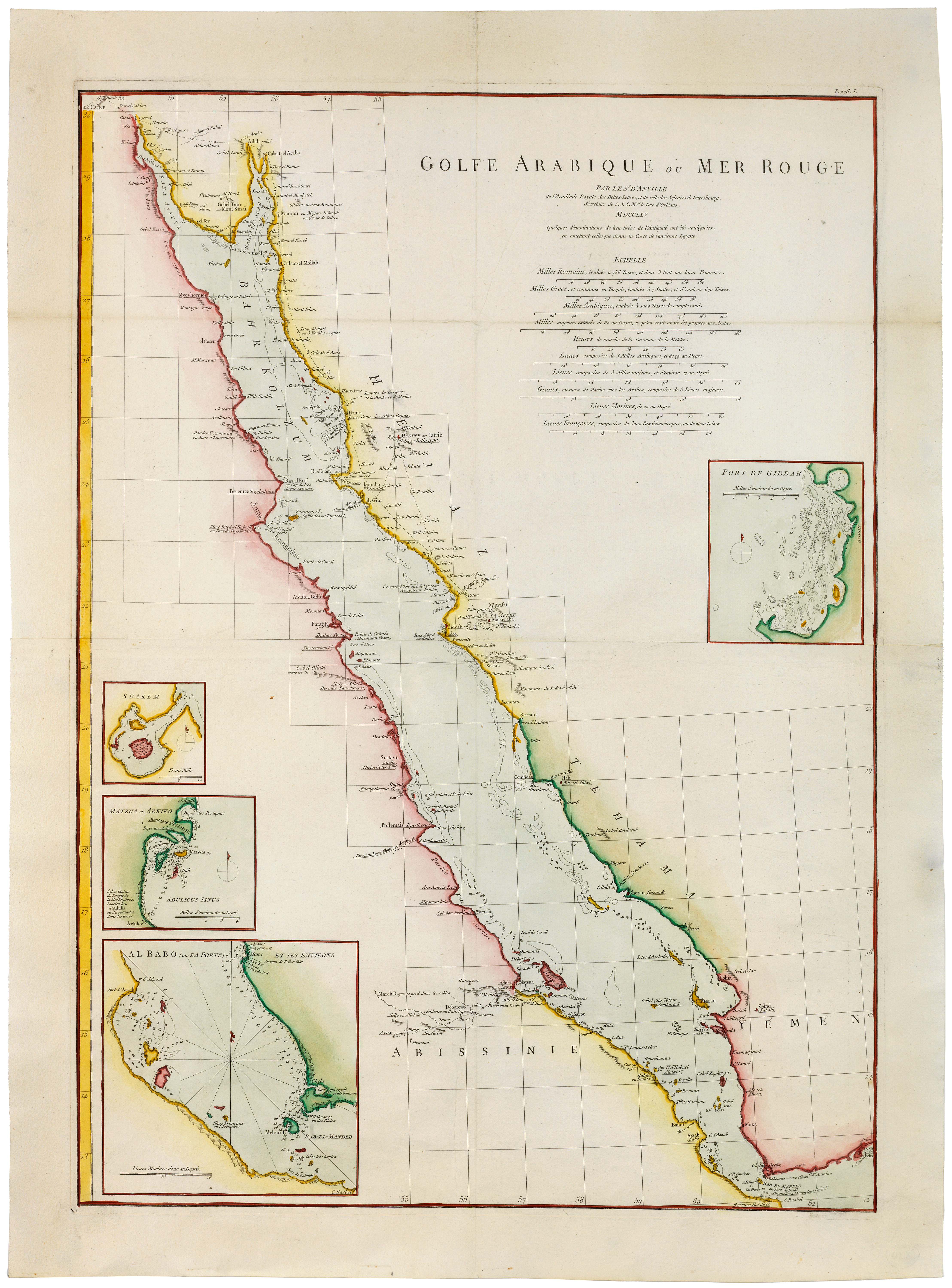
This large copperplate-engraved map of the Red Sea is entitled: ‘Golfe Arabique ou Mer Rouge Par le Sr. d'Anville de l'Academie Royale des Belles-Lettres, et de celle des Sciences de Petersbourg, Secretaire de S.A.S. Mgr. le Duc d'Orleans, MDCCLXV’. It marks: ‘Le Caire’ (Cairo), ‘Medine ou Iatrib Iathrippa’ (Medina), ‘Mt Ohhud’ (Mount Uhud), ‘Giddah’ (Jedda), ‘La Mekke Maco-raba’ (Mecca), ‘Mt Arafat’ (Mount Arafat) and a dotted line showing ‘Limites du Territoire de la Mekke et de Medine’ (the extent of the territories of Mecca and Medina).
D’Anville was a classical scholar and used ancient texts, including those in ancient Greek to help compile his maps; he was also certainly aware of some Arabic words and read Arabic literature in translation. In his important personal project entitled ‘Mémoires sur l'Egypte ancienne et moderne, suivis d'une description du Golfe Arabique ou de la Mer Rouge’ printed in 1766, d’Anville notes that Maco-raba is a term used by Ptolemy and he goes on (a year later than our map) to analyse the Red Sea in sixty pages. The reference to Maco-raba (Makoraba) to describe Mecca is indeed generally considered to be the classical name given to Mecca by Ptolemy in his Guide to Geography, although this is a contested attribution; d’Anville also uses the Ptolemaic ‘Lathrippa’ (Yathrib) to describe Medina. The Red Sea was of great interest during the eighteenth century, it being an opportunity to explore Egypt as well as the broader ancient world.